Roz Pidcock
01.06.2014 | 6:00pmGet set for more intense downpours as scientists say climate change is making heavy rainfall in summer more likely – at least in the southern part of the UK.
The Met Office’s new forecast is a scientific first, taking a fresh approach to the notoriously difficult problem of forecasting climate change for such a small region. So how confident are the scientists in the prediction?
It’s raining, it’s pouring
The new Met Office study predicts extreme summer rainfall will become more frequent in the UK as the climate warms.
The team, including scientists from the University of Newcastle, estimates that by 2100 we’ll see the sort of rainfall that leads to flash flooding – that’s more than 28 millimetres of rain falling in one hour – five times as often as we are now.

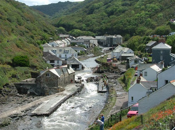
Intense summer rainfall led to devastating floods in Boscastle in 2004, and will get more common with climate change, according to a new Met Office forecast.
The new research, just published in Nature Climate Change, doesn’t mean British summers are going to get wetter overall. Scientists expect summers to get drier by 2100. But when we do get downpours, they’re likely to be heavier, say the scientists.
A recent crowd-sourcing project suggested climate change is making extreme heavy rainfall like we experienced in the UK last winter 25 per cent more likely. The new study says we can expect an increase in heavy summer rainfall too.
As forecasts go, the new one is very detailed, and it’s this unprecedented level of detail that makes the new study a scientific first. So what do the scientists say is special about the new Met Office forecast?
A model problem
Global Climate Models (GCMs) have done a good job of predicting changes in global average temperatures and rainfall in recent decades. But using global climate models to make accurate forecasts for areas any smaller than a whole continent is still a huge challenge for scientists.
That’s partly because climate modelling is a power-hungry exercise, pushing even the world’s biggest, most powerful supercomputers to their limits. No single model can give a detailed forecast for every postcode, right across the world, for a whole century.
Instead, global climate models have to approximate weather systems in different regions – and how they might change – rather than simulating them directly. Different models may do this in slightly different ways, all which makes for rather uncertain predictions at a regional level.
So there’s a huge amount of scientific interest in improving regional forecasting. The new Met Office study is an example of one approach to tackling the problem.

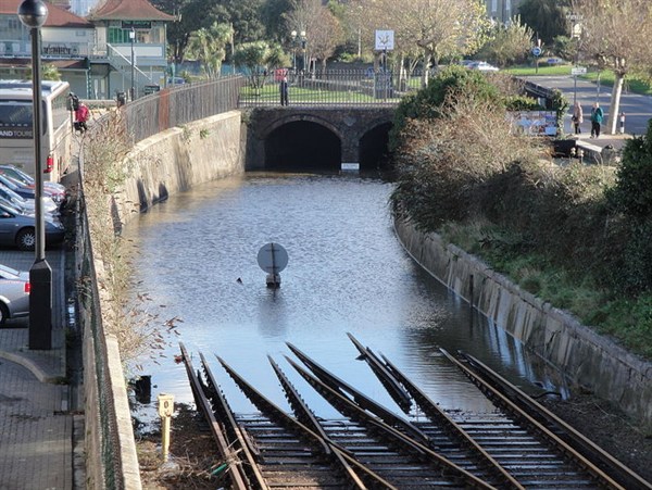
Heavy rainfall and flooding can disrupt important transport links, something we saw a lot of in the UK this winter.
A scientific first
The Met Office model takes a very specific region – the south of the UK – and uses all the computer power it would have taken to run a global model to sharpen up the detail about weather systems known to affect just this very small area.
This was still a very power-hungry exercise, as a Met Office press release explains:
“It was so computer intensive that only the southern half of the UK could be studied and even then it took the Met Office supercomputer – one of the most powerful in the world – about nine months to run the simulations.”
Running a model at such high detail makes the new study the first of its kind. Or as the Met Office puts it:
“The results of the study â?¦ are the first step towards building a more complete picture of how UK rainfall may change as our climate warms”
So the new forecast is more detailed than we’ve seen before, but is it more accurate?
How do we know we can we trust the forecast?
We don’t. Not yet anyway.
The Met Office scientists say they have confidence in their new forecast because the model realistically recreates the variations in hourly summer rainfall we see at the moment.
Less detailed models can’t capture the storms that lead to heavy summer rainfall – so they underestimate how much rain falls, when and where, the study explains.
It sounds promising. But being good at simulating what’s happening now doesn’t automatically translate to a reliable forecast, as explained in a recent article from climate scientists Jules Hargreaves and James Annan:
“An ability to simulate features of the current climate, while encouraging, does not imply that the models can accurately predict future climate changes, such as those expected under increasing levels of carbon dioxide.”
The point the piece makes is that it’s reasonable to assume that if a model does a good job of representing the current climate, the physical processes that underpin it are likely to be a good match with reality. But all models are simplifications of nature and more complicated biological processes, such as how carbon cycles through the atmosphere, are only starting to be included.
And as Dr Lizzie Kendon, lead author on the Met Office study says, it remains to be seen if other models back up the new forecast:
“[W]e need to be careful as the result is only based on one model – so we need to wait for other centres to run similarly detailed simulations to see whether their results support these findings.”
That said, the changes the Met Office model predicts are in line with what scientists expect as temperatures rise. A warmer atmosphere holds more moisture, approximately seven per cent more per degree Celsius temperature rise. That means when rain falls, it’s likely to be heavier.
Scientists are confident we’ll see more extreme rain in the UK as the climate warms – there’s no getting around those fundamental physical laws. As for the finer details of the forecast, we’ll have to wait and see if what the sparkly new Met Office model says will happen, happens.

